|
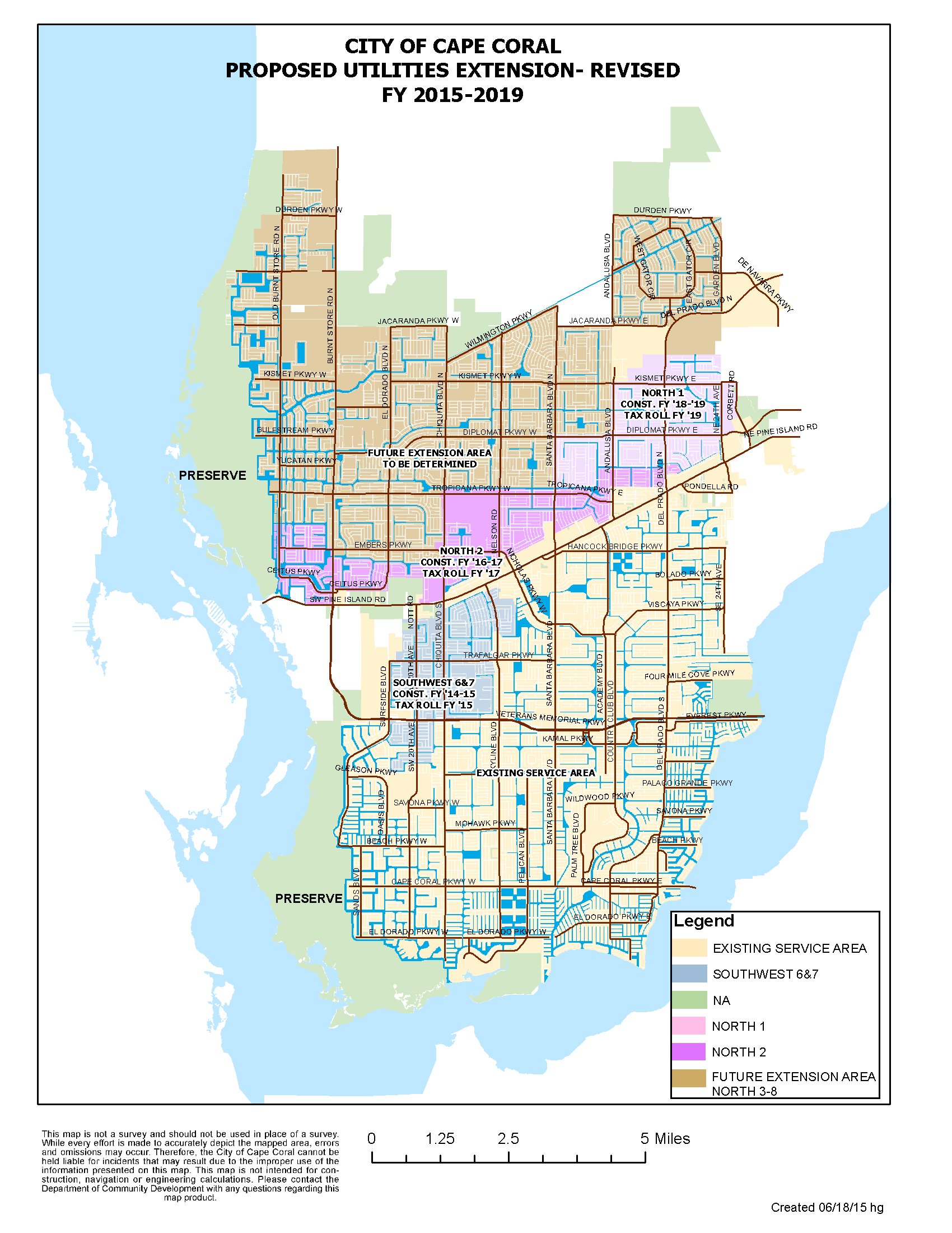
Cape Coral Proposed Utility Expansion Map
11/24/2014 Cape Coral Update The Cape Coral market is mixed depending on location and whether the property is gulf access. A survey of water front Looking at gulf access housing in SW Cape Coral west of Chiquita Blvd we find an 11% increase year over year and a 10.5% increase in the past quarter. Inventory has increased 65% in the past quarter, resulting in a 15 month supply at current sales rates. Looking at SE Cape Coral gulf access properties we find a 4.8% increase in the median sale price over the past 12 months. Like other sub markets inventory has increased 60% in the past three months, resulting a 6.94 months supply at current sale rates. Its interesting to note that, except for the Yacht Club neighborhood, prices have increased despite the higher inventory levels. Marketing times are generally less than 90 days. In each sub market the median listing days on market is lower in the past quarter due to the influx of new listings. Older listings are generally higher prices and have been listed for more than 90 days. The numbers above show the seasonal nature of this market, where many buyers list in the fall months in order to sell during the busier winter season. Sales activity typically peaks in the 1st quarter (Pending) and 2nd quarter (Closed) of the year and inventory then declines through the summer.
Cape Coral is a pre-planned, pre-platted city located on the gulf coast of Florida. Bordered by the Caloosahatchee River to the east and south, and Matlacha Pass to the west, the city is approximately 120 square miles in size and is reported to be the geographically largest city in Florida. The 2010 census places the population at 154,000 residents. The unique aspect of Cape Coral is its reported 400 miles of canals within the city limits, approximately half of which are salt water and allow boaters access to the Gulf of Mexico from their back yard canals and docks. The freshwater canals in the city are used for storm water control, and allow for boating and fishing within the city limits. Cape Coral began in 1957 when developers Jack and Leonard Rosen purchased approximately 103 square miles of land known as Redfish Point. It is reported that the first house was completed in 1957. Early development took place in the area now known as the Yacht Club neighborhood, and spread northward along the Caloosahatchee River. Waterfront living was the driving factor in the early development of this area. Prior to the housing boom of 2003-2006, nearly all development in Cape Coral, both residential and commercial, took place south of Pine Island Rd. Beginning in 2002, the residential real estate market accelerated and thousands of houses were built in the city. Previously undeveloped areas, including most of the city north of Pine Island Rd, experienced the most growth. Prices peaked in 2005 - 2006, and sales activity slowed until the foreclosures hit the market in 2008 and prices plummeted.
|

 sales and listings in the Yacht Club in the past year shows the median sale price increased 8.6% year over year but declined 11% from the previous quarter. Sales activity slowed 14% in the past three months, and the number of listings increased 44%, resulting in a 7.2 months supply at current sales rates.